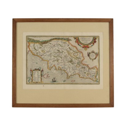
Map of The Ancient Etruria 16th-17th Century - Tusciae Antiquae Typus
Features
Tusciae Antiquae Typus
Artwork title: Tusciae antiquae typus
Age: 17th Century / 1601 - 1700 , 16th Century / 1501 - 1600
Subject: Maps
Artistic technique: Printing
Technical specification: Etching (Cable Engraving)
Description : Tusciae antiquae typus
Colored etching. It is the historical map of the ancient Etruria- known as Tuscia by Romans- pubblished on the Parergon, the addition of the "Theatrum Orbis Terrarum", the historical atlas of Abraham Ortelius (1528-1598); the map appeared for the first time iside the 1584's edition and it had been reproduced in several editions in 17th Century. At the top right, under the title, there is the name of Ortelius while at the bottom left there is a list of sites of uncertain location. It is in good conditions and is displayed in frame.
Product Condition:
Fair condition. Wear consistent with age and use. Product with a Certificate of Authenticity and Lawful Origin.
Frame Size (cm):
Height: 59
Width: 68
Depth: 2,5
Artwork dimensions (cm):
Height: 38
Width: 54


