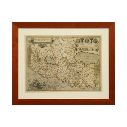
Abraham Ortelius - Map of the Holy Land
Features
Map of the Holy Land
Artist: Abraham Ortelius (1527-1598)
Artwork title: Mappa della Terrasanta
Age: 16th Century / 1501 - 1600
Subject: Maps
Artistic technique: Printing
Technical specification: Etching (Cable Engraving)
Description : Mappa della Terrasanta
Hand watercolored etching. It is taken from the Latin edition of the Theatrum Orbis Terrarum, the first modern atlas, including maps of all areas of the world; with a brilliant intuition, Ortelius brought together in a single corpus the heterogeneous cartographic production of the period, forming the basis for an enormously successful publishing enterprise, published several times starting from 1570. The map shows at the top the name of the territory described and of the author. The print is in good condition; the fold of the book is visible. Presented in the frame.
Product Condition:
Product in good condition, with small signs of wear.
Frame Size (cm):
Height: 55,5
Width: 69
Depth: 1,5
Artwork dimensions (cm):
Height: 39
Width: 52


